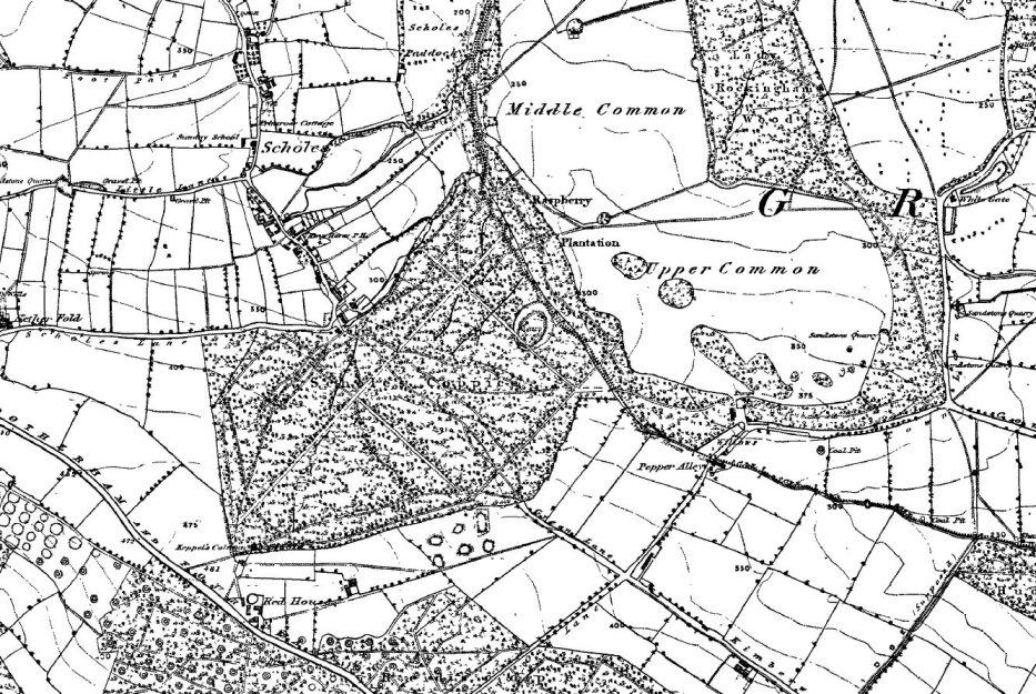
Map 1. 1930's OS map showing area of Ancient Woodland before clearances.
N.B.: Image produced from the www.old-maps.co.uk service with kind permission of Landmark Information Group . and Ordnance Survey
Click on the map for larger size:
Map 2. copied from local library map showing Wentworth estate boundaries. Also shows clearance area in 1950's when Kimberworth Park council housing estate was built and extent of clearance on Keppels (Admiral's) Field


 Holistic Fraternity Front page